The infrastructure beneath our feet
Most of us don’t think about what’s below the surface of the ground we walk or drive on, but the reality is that there’s a lot going on down there. The ground beneath our feet contains the pipes, tunnels and fibre optics that deliver our everyday services such as gas, power, water and telephone.
Knowing exactly where this ‘invisible’ infrastructure is located is essential for anyone who is going to dig including construction companies, utility providers and council agencies.
“Checking below the surface for any hazards before you dig is imperative for making sure the construction is safe before breaking the surface,”, says Campbell McNair, Global Survey’s detection specialist. “Hitting a live utility can be very costly not just in terms of repairs and loss of services but also the potential for severe injury and even fatalities.”
Seeing the ‘invisible’
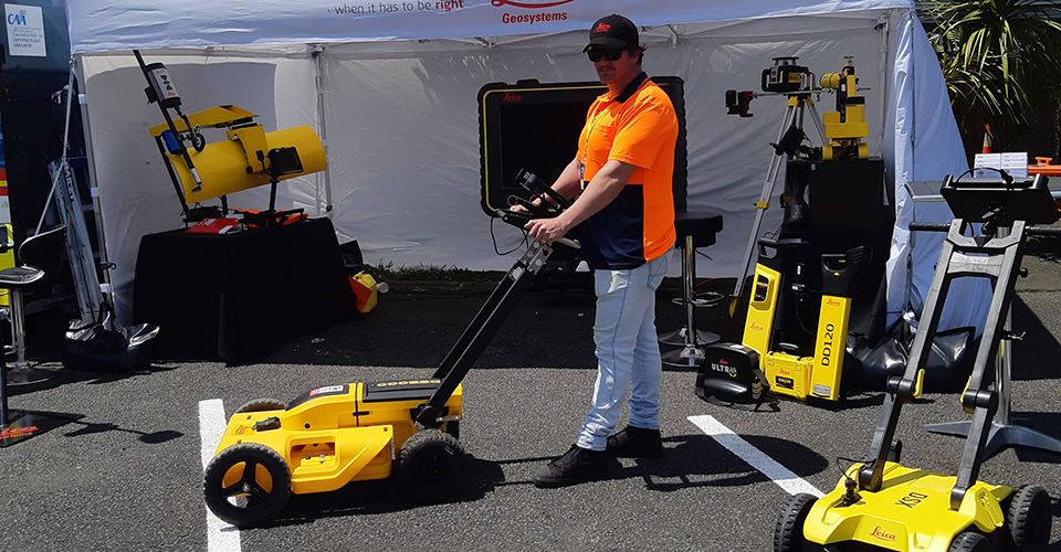
Ground Penetrating Radar, known as GPR, is a technology that can detect all underground utilities including non-conductive pipes and fibre optics. It provides a full picture of what is beneath the ground and identifies any potential threats, assisting in reducing cost, time and safety risks.
Global Survey are the New Zealand agent for Leica Geosystems, a global leader in surveying and construction technology. Global Survey specialises in detection technology sales, training and support, including state-of-the-art ground penetrating radar such as the Leica DS2000 GPR.
A challenging environment
The GPR tablet must be robust enough and powerful enough to meet the demands of the environments it is commonly used in:
- Weather conditions such as high and low temperatures, rain and direct sunlight.
- Worksites produce high levels of airborne particles such as dust and debris, and a rough environment where drops and knocks are common.
- Operators working in the rain need a large touchscreen that works with gloves and wet touch.
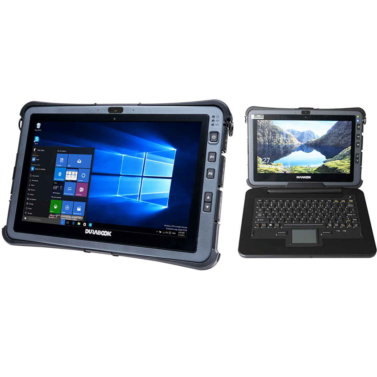
- Connectivity, both physical and mobile, is pivotal for accuracy and in the field - the U11I provides the ability to securely connect to the GPR’s radar for external high gain GPS location services, and 4G LTE with Band 28 support for uptime even in the most remote areas to ensure access, capture and syncing data live in the field.
- 3D mapping software can only run on a device with high performance computing power.
- Tight deadlines on larger projects require minimal downtime; hot-swap batteries ensure there are no interruptions in performance.
Meeting the demands with Durabook
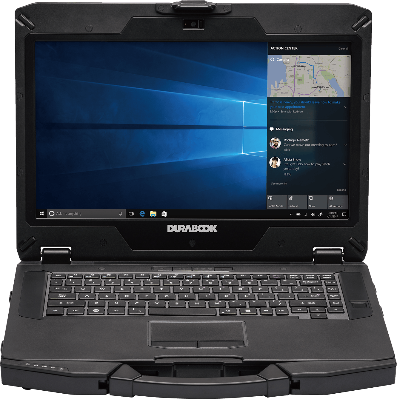
With these in-field challenges, Global Survey decided to test out the Durabook U11I fully rugged tablet, which comes optional with a detachable rugged keyboard, designed and purpose-built for outdoor environments. It runs a U-blox 72 channel dedicated GPS module and RF pass through antenna for high location accuracy when precision is paramount.
“We particularly liked that the display automatically adjusts to surrounding light,” said Campbell McNair, “this makes it easier for users to work outdoors in bright sunlight conditions.” The anti-glare and anti-reflective display, paired with the highest 1000 nits luminance, ensures screen readability at all times."
The Durabook U11I has been a hit with Global Survey. “We’ve had great service with Durabook which is supplied and serviced locally,” says Campbell McNair. “The product is delivered fast, and we’re provided with ongoing support which has been a great added bonus.”
With the combination of the Durabook U11I and Leica GPR, Global Survey offers customers a safer solution for locating New Zealand’s hidden underground infrastructure.